1 June 01, 2020
Articles
1. Takaaki Musha
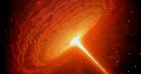
Black Hole and Large Number Hypothesis
Russian Journal of Astrophysical Research. Series A, 2020, 6(1): 3-6.
Number of views: 706 Download in PDF
2. Takaaki MushaRussian Journal of Astrophysical Research. Series A, 2020, 6(1): 3-6.
Abstract:
Large Number Hypothesis (LNH) was proposed by Paul Dirac. This coincidence of number was also recognized by Arthur Eddington who related the above ratios to N, which the estimated number of charged particles in the universe. This hypothesis shows some physical parameters depends on the age of the universe. For example, it shows the strength of gravity as represented by the gravitational constant is inversely proportional to the age of the universe. By applying this hypothesis to a black hole, it can be shown that the entropy of the black hole depends on the age of the universe and the thermal radiation from the black hole increases with time.
Large Number Hypothesis (LNH) was proposed by Paul Dirac. This coincidence of number was also recognized by Arthur Eddington who related the above ratios to N, which the estimated number of charged particles in the universe. This hypothesis shows some physical parameters depends on the age of the universe. For example, it shows the strength of gravity as represented by the gravitational constant is inversely proportional to the age of the universe. By applying this hypothesis to a black hole, it can be shown that the entropy of the black hole depends on the age of the universe and the thermal radiation from the black hole increases with time.
Number of views: 706 Download in PDF
Negative Gravity Force Created by Gravitational Collapse of the Star
Russian Journal of Astrophysical Research. Series A, 2020, 6(1): 7-14.
Number of views: 675 Download in PDF
3. Vladimir V. OznametsRussian Journal of Astrophysical Research. Series A, 2020, 6(1): 7-14.
Abstract:
General relativity theory predicts that the star of greater than 2.5 solar masses collapses into a black hole when it burns up all its nuclear fuel. But some scientists are skeptical about the existence of a black hole. The author studied the possible existence of faster-than-light phenomena for highly accelerated elementary particles. By applying his theorem to the collapsing star, it can be shown that negative gravity due to tachyons created inside the star prevents all the star’s matter to be completely crushed into a singularity and it is considered that the collapsing stars become unstable by their negative gravity forces generated by created tachyons and they may be finally exploded.
General relativity theory predicts that the star of greater than 2.5 solar masses collapses into a black hole when it burns up all its nuclear fuel. But some scientists are skeptical about the existence of a black hole. The author studied the possible existence of faster-than-light phenomena for highly accelerated elementary particles. By applying his theorem to the collapsing star, it can be shown that negative gravity due to tachyons created inside the star prevents all the star’s matter to be completely crushed into a singularity and it is considered that the collapsing stars become unstable by their negative gravity forces generated by created tachyons and they may be finally exploded.
Number of views: 675 Download in PDF
Geodesic Support of Space Research
Russian Journal of Astrophysical Research. Series A, 2020, 6(1): 15-22.
Number of views: 674 Download in PDF
4. Viktor P. SavinychRussian Journal of Astrophysical Research. Series A, 2020, 6(1): 15-22.
Abstract:
The article analyzes the geodetic support of space research. The article shows that geodesy is a science of space, and therefore, geodesic support can be extended to outer space. The analysis shows that the components of the geodetic support of space research are: space geodesy, geodesic astronomy, satellite geodesy and space geoinformatics. The geodetic support of space research has five directions of development. The geodetic support of space research has two groups, each of which includes all five areas. The first group is aimed at supporting Earth exploration from outer space and near-Earth outer space and aimed at exploring extraterrestrial space. The second group of geodetic support for space research is aimed at supporting research on extraterrestrial space. The article highlights the strategic and tactical tasks of geodetic support for space research. The main model, which is formed on the basis of the geodetic support of space research, is a three-dimensional model and a triangulation model for covering the surface of spatial objects. The article justifies the new term "geodetic support for space research". The article confirms the conclusion that geodesy and geoinformatics are applicable for the study and measurement of space bodies.
The article analyzes the geodetic support of space research. The article shows that geodesy is a science of space, and therefore, geodesic support can be extended to outer space. The analysis shows that the components of the geodetic support of space research are: space geodesy, geodesic astronomy, satellite geodesy and space geoinformatics. The geodetic support of space research has five directions of development. The geodetic support of space research has two groups, each of which includes all five areas. The first group is aimed at supporting Earth exploration from outer space and near-Earth outer space and aimed at exploring extraterrestrial space. The second group of geodetic support for space research is aimed at supporting research on extraterrestrial space. The article highlights the strategic and tactical tasks of geodetic support for space research. The main model, which is formed on the basis of the geodetic support of space research, is a three-dimensional model and a triangulation model for covering the surface of spatial objects. The article justifies the new term "geodetic support for space research". The article confirms the conclusion that geodesy and geoinformatics are applicable for the study and measurement of space bodies.
Number of views: 674 Download in PDF
Visual and Instrumental Observations from the Spacecraft
Russian Journal of Astrophysical Research. Series A, 2020, 6(1): 23-34.
Number of views: 698 Download in PDF
5. Sergey V. ShayturaRussian Journal of Astrophysical Research. Series A, 2020, 6(1): 23-34.
Abstract:
The article examines space visual-instrumental observations used in observing space objects and phenomena. Visual instrumental observations include: observation by the human eye, the human eye and an optical device, only an optical or photogrammetric device. The article describes the features of observation of moving objects in outer space. The article proves that there is a distorted perception of the size of fast-moving objects in outer space. The article describes the distortion of the color perception of fast objects in space. The article proves that the purpose of visual-instrumental observations is to build scenes and achieve a holistic perception or gestalt. The article shows the importance of perception, reception and apperception in visual and instrumental observations. Experimental observations of space objects are given. The article proves that the angular measurements of space objects are a stable quantity and can be the basis for visual space observations. Angular measurements of space objects can be used in comparative analysis and comparative planetology.
The article examines space visual-instrumental observations used in observing space objects and phenomena. Visual instrumental observations include: observation by the human eye, the human eye and an optical device, only an optical or photogrammetric device. The article describes the features of observation of moving objects in outer space. The article proves that there is a distorted perception of the size of fast-moving objects in outer space. The article describes the distortion of the color perception of fast objects in space. The article proves that the purpose of visual-instrumental observations is to build scenes and achieve a holistic perception or gestalt. The article shows the importance of perception, reception and apperception in visual and instrumental observations. Experimental observations of space objects are given. The article proves that the angular measurements of space objects are a stable quantity and can be the basis for visual space observations. Angular measurements of space objects can be used in comparative analysis and comparative planetology.
Number of views: 698 Download in PDF
Determining the Coordinates of Points on the Surface of a Space Body
Russian Journal of Astrophysical Research. Series A, 2020, 6(1): 35-45.
Number of views: 650 Download in PDF
6. Viktor Ya. TsvetkovRussian Journal of Astrophysical Research. Series A, 2020, 6(1): 35-45.
Abstract:
The article examines the method and algorithm for determining the coordinates of points on the surface of a space body. The article introduces a generalized concept of a cosmic body. This concept includes: planets, planetary satellites, asteroids, comets, small celestial bodies. The survey is carried out from the board of a spacecraft moving past a space body. The trajectory of the spacecraft is considered flat and not perturbed. Rotating the camera creates an overlap area for a pair of photos. Determination of the coordinates of points on the surface of a space body is carried out by photographs. To solve the problem, inertial determination of the coordinates of the spacecraft and rotation of the camera through a known angle are required. The direct photogrammetric intersection is solved under the condition of equality of scales. The non-coplanarity of the vectors defining the position of the point on the surface and the space body is allowed. The method is applicable to determine the coordinates of points on the surface of the Earth and on the surface of other planets.
The article examines the method and algorithm for determining the coordinates of points on the surface of a space body. The article introduces a generalized concept of a cosmic body. This concept includes: planets, planetary satellites, asteroids, comets, small celestial bodies. The survey is carried out from the board of a spacecraft moving past a space body. The trajectory of the spacecraft is considered flat and not perturbed. Rotating the camera creates an overlap area for a pair of photos. Determination of the coordinates of points on the surface of a space body is carried out by photographs. To solve the problem, inertial determination of the coordinates of the spacecraft and rotation of the camera through a known angle are required. The direct photogrammetric intersection is solved under the condition of equality of scales. The non-coplanarity of the vectors defining the position of the point on the surface and the space body is allowed. The method is applicable to determine the coordinates of points on the surface of the Earth and on the surface of other planets.
Number of views: 650 Download in PDF
Planetary Altimetry
Russian Journal of Astrophysical Research. Series A, 2020, 6(1): 46-52.
Number of views: 674 Download in PDF
7. Russian Journal of Astrophysical Research. Series A, 2020, 6(1): 46-52.
Abstract:
The article describes a method for determining the coordinates of points on the planet's surface if there is a laser altimeter and a photogrammetric system on board the spacecraft. Both devices are linked and coordinated in the spacecraft system. There is a possibility of converting the ranges of the laser altimeter into a photogrammetric coordinate system associated with the front nodal point of the camera. The altimeter marks points on the planet's surface. These points are recorded by the photogrammetric system in the image. Measurements of the coordinates of the points of the images make it possible to determine the spatial configuration of points on the planet's surface in real scale. Spatial configuration is analogous to a hanging geodetic network. An estimate is given of the errors caused by the movement of the spacecraft relative to the planet. The field of application of the method in terrestrial conditions is described.
The article describes a method for determining the coordinates of points on the planet's surface if there is a laser altimeter and a photogrammetric system on board the spacecraft. Both devices are linked and coordinated in the spacecraft system. There is a possibility of converting the ranges of the laser altimeter into a photogrammetric coordinate system associated with the front nodal point of the camera. The altimeter marks points on the planet's surface. These points are recorded by the photogrammetric system in the image. Measurements of the coordinates of the points of the images make it possible to determine the spatial configuration of points on the planet's surface in real scale. Spatial configuration is analogous to a hanging geodetic network. An estimate is given of the errors caused by the movement of the spacecraft relative to the planet. The field of application of the method in terrestrial conditions is described.
Number of views: 674 Download in PDF


